Sunday, May 31, 2015

The Copper Canyon - Part 3 - April 18 - 28, 2015


. . . and when we got off the train, we were in 


Creel

Creel is the very definition of a laid-back mountain town: cool mountain air smelling of pine trees; cowboys; trucks; companies offering mountain bike and horseback riding tours; t-shirt shops; indigenous women and children selling tourist articles; and some very basic restaurants. (Warning: the one espresso machine we found in town doesn't operate until mid-afternoon . . .!)


Downtown Creel

Creel is also one of the primary departure points for those who want to go down into the canyons or get as close as casual travelers can to the indigenous people of the area, the Tarahumara. [For those that are interested in a little bit of information about this indigenous group we've added a few paragraphs at the bottom of this post with some links.]

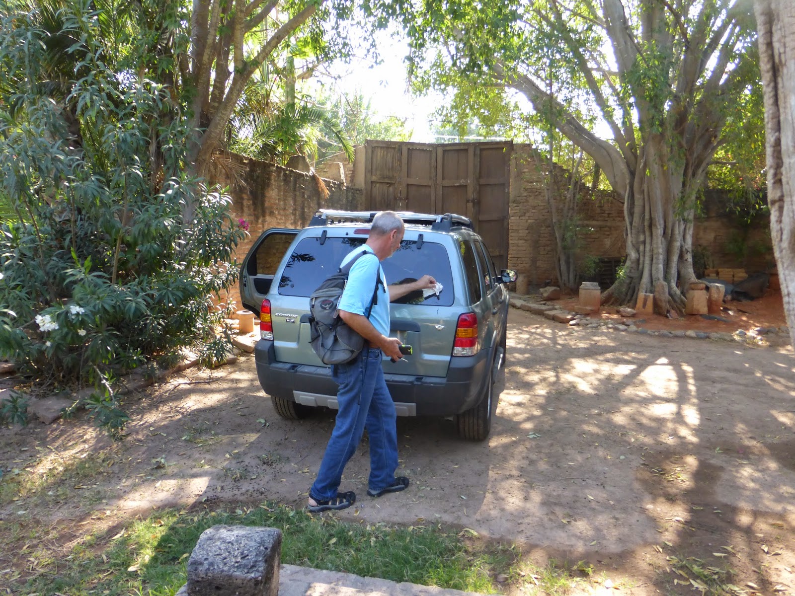
We hadn't made hotel reservations but the crew of Full 'n By had recommended the Hotel Casa Mexicana to us. We rolled our suitcases through the small, animated crowd of hotel touts gathered around the train station. No one from Hotel Casa Mexicana was in evidence, but we finally understood that the representative of the Casa Margarita's hotel would get us to the Hotel Casa Mexicana; the same family owns both hotels.   

Hotel Casa Mexicana is a very clean and attractive motel-style place with a pleasant courtyard. Breakfast and dinner were included for about $50 US a night. And - this is important in a town located at 2330 meters (7500+ feet) - heat was included. [Travel Tip: Some hotels charge extra for heaters to be turned on.]


Hotel Casa Mexicana

We had been warned that the included breakfasts and dinners would be unexciting, so we were not disappointed. 

An Aside On Our Dining Experiences: The majority of mid-range restaurants in Small Tourist Town, Mexico are best described as . . . uninspired. Most offer the same menu and the cooking reflects a passion for the art reminiscent of public school cafeterias we have known. So, unless we are experiencing travel dining fatigue and want something calming (a club sandwich can be found in most restaurants), we follow our taste buds to the best-smelling taqueria or tortaria in town and tell ourselves we will worry about our waistlines later. 


Tour Package #1:

After visiting several tour companies and hotels we realized they all offer the same five basic mini-van day trips. We booked a Tour #1 through our hotel. 

There are more adventuresome ways to see the area around Creel: mountain bikes, a four-wheeler, a scooter and horses are some of the transportation options available. And for those that enjoy the challenge of finding their own way around, it is also possible to do a self-guided tour (i.e., rent a four-wheeler, get a map). For us, a van tour was just fine. We enjoyed our guide and the young Japanese tourist who was the only other person on the tour. And even better, we didn't have to drive the extremely sketchy road to the Cusarare waterfall. Travel Tip: Costs are based on a group of four or more; if you can find fellow travelers your costs will be lower.

               Stop One - Tarahumara House: The Tarahumara originally lived in caves, and some families maintain these traditional dwellings.    


Home Sweet Cave

We were told the one large room wedged beneath the side of a hill, was home to ten people. The food preparation area made Molly feel very spoiled for complaining about some of the Airbnb kitchens she has known. 


The Kitchen


               Unsolicited and Random Thoughts On "Poverty Lifestyle Tourism": Travelers and tourists are often offered the opportunity to visit communities that, by choice or otherwise, maintain a culture that differs from the majority culture. We have visited Maya communities in Chiapas; the people of the floating islands in Lago Titicaca, Peru; various non-Thai communities In Thailand; and on this trip, Tarahumara communities

Many of these minority cultures are economically marginalized. And that sometimes leads us to wonder about the ethics of what, in our more cynical moments we think of as "poverty lifestyle tourism". We want to believe that we are there to learn about and honor a unique culture. We worry that we are perceived as (comparatively, very) wealthy, condescending gawkers. We know that the money we bring isn't a real solution to the problems of a marginalized community (inadequate clean water, transportation, education and health care, to name a few). But it is also true that tourism money can help and that a robust tourism industry can focus governmental attention on a community's needs. For example, the solar panel that generates light for the cave we visited was probably paid for, at least in part, by tourism pesos. 

These are issues that every (comparatively wealthy) traveler, particularly those from Developed Nations, must deal with. We will continue to struggle with them though, at this point, we still believe that visiting in as culturally sensitive a manner as possible is better than ignoring these communities. 

Travel Tip: Look for the tip box in the cave. 


               Stop One, Continued: Our tour guide explained that the Mexican government has assisted the Tarahumara in building small homes to replace their cave dwellings. We don't know why the family in the cave chose to remain in their cave -- just one of the limitations of being a day tourist.   


A Tarahumara Home


                Stop Two - Lago Arareko: This is a pretty lake outside of Creel. We took a short walk and purchased a pot-holder from a young woman that followed us. We asked for a photo in addition to the potholder and, though she was shy, she agreed to pose for us.


Tarahumara Saleswoman

               Side Note Re: Shopping: Travelers have many opportunities to purchase baskets, dolls and potholders from Tarahumara saleswomen and saleschildren. We chose to make most of our purchases from the Artesanias Mision, a store near the train station and on the main square in Creel. We are told that the store's earnings support a hospital that provides free medical care to the Tarahumara. 


                Stop Three - Cusarare Waterfall: We chose to walk about a mile to the falls, though there is a (very patchy) road that can take visitors closer. Along our path we passed many Tarahumara saleswomen and their pre-school aged children. Every day is Take your kid to work day in the Tarahumara world.


Across A Swinging Bridge

A young Tarahumara boy began to follow and point to various turns in the trail. Bryce learned that his name was Arturo, and asked him if he would be our guide to the falls. The offer was for a "guide fee" of ten pesos. Arturo solemnly agreed to this engagement. The path to the falls was well marked, but Arturo was charmingly serious about his guide responsibilities. He ran ahead of us, and pointed which way we should go at every turn. 

Bryce learned that Arturo was six years old and that he attended a boarding school for Tarahumara children which was closed on that particular Tuesday. When our "tour" was finished, Arturo happily posed for a picture.


Bryce and Our "Guide" Arturo

The waterfalls are very pretty, even at the end of the dry season. They must be spectacular in July and August, when the rains come. 

Cusarare Falls

The path to the bottom of the falls includes over 200 steps. Bryce decided his new hip had been through enough already, and stayed above to chat with Arturo. Molly made it to the bottom of the 200 stairs. . . .


Molly At The Falls

. . . and eventually, veery sloowly, back to the top.


               Stop Four - San Ignacio Mission: This 18th Century mission is located in the San Ignacio Ararejo Ejido (an ejido is a communal land ownership area established under Mexican law). It is a lovely place.


               Stop Five - The San Ignacio School: We stopped at a boarding school for Tarahumara children. Our tour guide explained that there are several of these boarding schools in the canyons area because many Tarahumara live in areas without roads and others are without reliable (or any) motorized transportation. Children who are not able to walk to school on a daily basis attend schools where they are housed and fed from Sunday evening through Friday afternoon. They return home during the weekend. 

We were happy to see the school was closed for the day - that meant our friend Arturo was legitimately free-lancing at the Cusarare waterfalls, and not skipping school.  In response to our questions we were assured that the schools were culturally sensitive to the Tarahumara and that the classes were taught in both Tarahumara and Spanish. We hope that is also the assessment of the children and their parents.


               Stop Six - The Valley of the Frogs and Mushrooms: Big rocks are a thing in the area. One can't take a tour and not be shown these amazing rocks  -- so, it's best to just get into the idea. 


El Elefante (The Elephant)
[Included Here Because It Was Bryce's Favorite Big Rock]

The Frog -- Uhm - It's Behind Us!

A Mushroom -
This One Wiggles When Pushed

Molly's favorite rocks weren't frogs or mushrooms or elephants, but little ones used, along with some plastic bottle caps, by some local children to build a doll house. These moments of universality make traveling fun.  


Too Small For Barbie

In sum: We enjoyed the tour, and felt that we learned something about the area and the Tarahumara people. FYI, we paid 500 pesos each (about $67 US for both of us) because we were a group of three. Travel with friends that equal a group of four and you'll get a better deal.


               Next Post: The other thing to do in Creel is to leave town - and take a trip down into the canyons . . . which is what our next post will be about.


Some (Very Basic) Information About the Tarahumara:

The Tarahumara originally inhabited much of the area that is now the state of Chihuahua, but retreated to the canyons area when the Spanish arrived and made life . . . difficult. 

After several centuries, two general groups of Tarahumara have evolved, the alta (upper) who live at the top of the canyons, including the area around Creel, and the baja (lower) who live in the canyons. There are differences in dress and culture between these two groups, in large part because the climate differs so radically between the top of the canyons (e.g., Creel at 2330 meters / 7,644+ feet) and the bottom (e.g., Batopilas at 764 meters / 2,506+ feet). 

The alta Tarahumara men all seem to dress in "traditional Chihuahuan" style - blue jeans, boots and cowboy hats. The same is also true for most baja Tarahumara men, though some baja Tarahumara maintain traditional dress.


Traditional Baja Tarahumara Dress

Tarahumara women wear traditional clothing more often than the men. They dress in brightly colored skirts and blouses. The alta Tarahumara also wrap in warm shawls.


Traditional Female Dress - Alta Tarahumara


The name the Tarahumara people use for themselves, Raramuri, translates to something like "those who run fast". The men compete in a traditional game called rarajipari, in which teams, in relay, kick a wooden baseball sized ball for miles - wearing leather sandals. In the past two decades many Tarahumara have become celebrated ultra-marathoners. The town of Urique hosts an annual ultra-marathon, the Ultra Marathon Caballo Blanco.   

There is so much to say about these people and their culture that we can't begin to cover it here. For those that want to know more, see this interesting National Geographic article

Monday, May 25, 2015

The Copper Canyon - Part 2 - April 18 - 28, 2015


All Aboard Chepe - Eastbound (First Class):

Early (for us - 08:30ish) on Monday morning at the train station outside of Fuerte we boarded the first class Ferrocarril Chihuahua Pacifico (Chihuahua Pacific train) bound for Creel, Chihuahua. [The nickname "Chepe" comes from the Spanish pronunciation of the train's initials: Ch = Che / P = Pe.]


Bryce At The El Fuerte Station

Some seven hours later we arrived in Creel after having: 

  • traveled 275 kilometer (170-ish mile) through the rugged Sierra Madre Occidental;   
  • gained 2,200 meters (7,000-ish feet) in elevation; 
  • crossed the Continental Divide;
  • traversed several tunnels, the longest of which was 1500 meters (almost a mile);
  • experienced a three-level switchback assent and a 360-degree circular switchback inside a tunnel;
  • crossed several dramatic bridges; 
  • negotiated for photography space on the train's platforms with smokers from a European tour group; and
  • had a passable lunch in the dining car.
The literature that describes Chepe as an engineering masterpiece does not exaggerate! 


For a couple of hours after the train left Fuerte we traveled through flat scrub and farmland. We had occasional glimpses of the mighty Rio Fuerte. We read and had coffee in the dining car. 


More of the Mighty Rio Fuerte

Then, about 100 kilometers out of Fuerte the train began to climb. And climb. And climb. The terrain began to change. We were in the mountains.


We Passed Waterfalls


We Passed Towns Too Small For A Station

At Temoris passengers can see the three levels of track the train uses to gain elevation. For your viewing pleasure, we captured only one:


At Temoris We Could See The Future

The only stop of any duration (about 15 minutes) along the route is at Divisadero, the location of the Continental DivideWe watched our fellow travelers purchase handicrafts from the rail-side vendors.  


Baskets, Anyone?

We took a short walk to a view-spotting platform, a bit nervous that we would not hear the train's whistle in time to re-board. 

Bryce Listening For The Departure Whistle
The View From Divisadero -- Probably Urique Canyon

Chepe at Divisadero

Because we had already had lunch in the dining car, we didn't buy a station gordita. But they looked and smelled good.


Mexico's Version Of The Whistle Stop Cafe


After Divisadero the train continued to climb.  


Up and Up and . . . 

At one point the train entered a tunnel and traveled (we were told, and the route map reflects) a full 360 degrees, back over its track, to gain elevation. It was eerie to know it was happening as we swayed through the dark.

For travelers interested in trains, engineering or geography this is a wonderful trip.

Westbound (Economic Class): 

Eight days later, around 3:00 in the afternoon (a time only tangentially related to any printed schedule we had seen) we boarded an economic class car on a combined first and economic class train at Posada Barrancas and rode 213 kilometers (132-ish miles) westward for about five hours to Fuerte. 


The Posada Barrancas "Station"

This was the first time we had even heard that Chepe ran a dual class train (one with both first and economic class cars). The website reflects two different classes of train; the economic class train running only three times a week in each direction. [Travel tip: Check with your hotel - ours seemed to know train mysteries that were not reflected on the Chepe website (click the English button) or at the stations!] 

We had equipped ourselves with snacks and water at our hotel, and didn't really miss not having access to a dining car (only on first class trains) except as a diversion on a long ride. Our economic class tickets cost only $68 for both of us. And there was an additional bonus to riding in the economic class car: our fellow passengers. We traveled with a musical group on its way to a gig in Fuerte, and were entertained by their acoustic versions of Mexican standards until they took a snack break. It made our train ride a true Mexican Moment.


Traveling Musicians

And For Bonus Points: 

For those interested enough to wade through some additional travel and Chepe-related ramblings without the benefit of photographs, we have the following:

               Trip-Related Decisions:

     1.  Train Class. Historically, Chepe has run two classes of train using the same cars. This means the differences between first and economic class trains have been price; the dining car on first class trains; and the schedule. First class trains runs daily and economic class trains run only three times a week in each direction. The economic class train has much more frequent stops (it can even be flagged down at certain places), and is less frequently on schedule.  

But see our dual class train experience above. Clearly (randomly? occasionally? only once?) Chepe has run a dual class train that is not reflected on its website. If the schedule is the same it makes even more sense to pack a lunch and travel in the economic class cars for half the price!  

We chose to travel first class on our eastbound trip because we were traveling on a Monday and Chepe does not run an eastbound economic class train on Monday (or at least that's what the schedule reflects . . . ). Another decision-maker was that we had heard it can be difficult to get a ticket for the economic class train because it is so crowded. Our westbound experience suggests that economic class cars are somewhat more crowded - but we probably could have traveled economic class on our eastbound trip had we traveled on Sunday or Tuesday. 

Our westbound economic class trip was perfectly comfortable, and a lot less expensive. If we travel this way in the future, we'll probably schedule around taking the economic class train. 

     2. Advanced Ticket Purchase. We did not buy tickets in advance, and were able to purchase tickets on the train in both directions. Here's how that worked: the conductor asked for our tickets; we said we didn't have them yet; he assigned us seats and took our ticket payment (about $150 for both of us) after the train left the station. Travel Tip: Paying on board requires cash; the conductors aren't equipped with credit card machines. We received a fully descriptive ticket (number of passengers, destination, price, etc.) for our cash. 

     3. Overall Comfort. The cars were comfortable, if a bit shabby and over-air-conditioned. Travel Tip: Bring a sweater or jacket, and not just for the over-air-conditioned car. See above re: altitude change. It will be a lot cooler in Creel or Divisadero than in Fuerte

The dining car was just fine. We had morning coffee and lunch on board. Food and beverages are for sale from time to time in the economic class cars. Travel Tip: In case the food vendors in the economic class cars aren't on your schedule, bring some water and snacks aboard. Alcohol is officially banned from all but the dining car. We did not see anyone ignoring this rule.  

     4. Route. On our eastbound trip we chose not to take the train from Los Mochis because (a) we knew we wanted to stop in El Fuerte and (b) had read that the portion of the route from Los Mochis to Fuerte didn't pass through any more interesting terrain than we could see from the cuota (toll road). Maps reflect that between Fuerte and Divisadero the train is the only way to go unless you have a rugged 4-wheel drive and a fearless driver. 

On our westbound trip, we took a bus from Creel west to the Posada Barrancas stop because we knew we wanted to spend a couple of days near there. The bus trip - or, rather, waiting for the bus - is a separate story; self-directed travel is not always seamlessly efficient.

               A Highly Condensed History of ChepeThere are dozens of Internet sites with information about this train trip, and a number of them explain a bit about the train's history. But for those who prefer one-stop shopping, here is (to us anyway) some interesting information:   

Chepe took almost 80 years to complete. 

Alfred Kinsey Owens, the man behind the Utopian socialist community in Topolobampo (see our prior post for some information about this guy) was given a concession to build a railway at Topolobampo in the 1880's. His plan was to build a railroad that ran from Kansas City into Mexico, through the Sierra Madre Occidental, to the port of Topolobampo. It's all about goods movement.

At some point the concession and some partially completed railroad was owned and operated by the Kansas City, Mexico and Orient Railway. The KCM&O completed the U.S. portions of the dream. However the Mexican route was not completed because of delays caused by the Mexican Revolution (1910 - 1920ish) and cost overruns due to the rugged terrain of the Sierra Madre Occidental

When the Mexican government nationalized the country's railroads in 1940 the Chepe route was only partially built. The government completed it in 1961. And they say government construction projects can't be efficient.. . 

Chepe is now operated by a private entity, Ferromex. [Privatization being the current efficiency craze.] 

For information about the first and economic class passenger routes Ferromex runs as Chepe it's best to check out the Chepe website. It may not be completely accurate at any given time (see our experience above) - but it is the official word.

Now, as we said -- on to Creel.


Thursday, May 21, 2015

The Copper Canyon - Part I - April 18 - 28, 2015


Tourism literature refers to "The Copper Canyon" as "Mexico's Grand Canyon". Like all good tourist marketing slogans, this captures the attention of would-be travelers. But it doesn't do this area justice. 

Random Background Information

The "Copper Canyon" is just one of the largest in a vast system of (depending on who is counting) 20 canyons covering more than 25,000 square miles within the Sierra Madre Occidental mountains. The largest of these canyons, Urique, is deeper than the Grand Canyon. Even the casual traveler has the opportunity to see three of the largest canyons - Septentrion, Urique, and del Cobre (Copper) and countless smaller canyons. We went a bit further and added the Batopilas canyon to our trip. 
One Of Many Spectacular Views

The name Barranca del Cobre (Copper Canyon) comes from the Spanish explorers who - as conquerors are wont to do - went looking for natural resources to exploit and thought they had found copper. They didn't find copper but the name stuck.

The canyons were formed by six rivers which eventually converge to create the Rio Fuerte (Strong River) which flows into the Golfo de California (Sea of Cortez) at the site of a port town called Topolobampo. Sounds like a 1950's dance craze, no?


The Mighty Rio Fuerte

One could spend - and some have spent - years exploring the vast canyon system. Less scientific travelers usually focus on the Parque Nacional de las Barrancas del Cobre (the Copper Canyons National Park) and the train that crosses it. The train is the Ferrocarril Chihuahua Pacifico (Chihuahua Pacific Train) which operates a 653 kilometer-long (405 mile) tourist class train between the airport city of Los Mochis, Sinaloa and the airport city of Chihuahua, Chihuahua. Along this route the train offers spectacular views of the barrancas. Some tours call this the "Train To The Sky". We prefer the less elaborate (and more common) name the locals use: El Chepe (from: Ch(ihuaua) / P(acific)). 


Riding The Rails

Many Ways To Travel

The Internet is full of prearranged tours to the Barrancas that range from educational, spectacular-view tours by train or even private airplane to trekking tours or mountain biking tours that offer the opportunity to exhaust oneself. These tours will provide English-speaking guides, many of whom are well educated on the culture, art and topography of the area; prearranged lodging, meals and transportation; prearranged sports equipment (camping gear, mountain bikes, etc.) and the comfort and enjoyment of being with a group of travelers with a similar interest (fishing, mountain biking, folk art, etc.).

More frugal (or even downright cheap) travelers can experience the canyons on a self-directed tour like we did, by simply: 
  • researching the area via books and/or the Internet (Spanish language websites can be translated using a variety of auto-translate features - which can result in some pretty funky though functional translations);
  • deciding what to see and do, often based on reading the itineraries of high-priced prearranged tours posted on the Internet;   
  • arranging travel to and from the area (we arrived in El Fuerte by car; travel to Los Mochis/El Fuerte or Chihuahua by plane can be arranged using the Internet);
  • purchasing train and/or bus tickets after arrival;
  • booking hotels using the Internet (Hotels.com is a favorite of ours);
  • choosing most restaurants based on what we see and smell, and the occasional splurge restaurant based on Internet reviews (yes, TripAdvisor has reviews of restaurants in Creel and Chihuahua!);
  • hiring local guides for tours when necessary or desired (there are English-speaking guides in the canyons area) through hotels or based on Internet reviews; and
  • taking day hikes based on information provided by locals and park employees (we are too old and cautious for mountain biking). 
This self-directed approach is easier for Spanish speakers (or, in Molly's case, someone traveling with a Spanish speaker), but Spanish fluency isn't required. It's possible to enjoy a self-directed trip using friendliness, mime and a willingness to learn and use a few necessary phrases found in the back of most tour books. 

The next few posts will talk about how our self-directed trip worked for us.


So We Begin

We drove north from Mazatlan and spent the night in Los Mochis. Los Mochis isn't much of a tourist destination but it's worth a night if you go to El Farallon for dinner and you are lazy drivers like we are. 


El Fuerte

Our next stop was the town of El Fuerte (The Fort), referred to by locals as simply Fuerte (which would be translated as "strong" except it's just a shortening of "the fort"). 


El Fuerte from Museo Mirador El Fuerte
(The El Fuerte Overlook Museum)

Fuerte is one of the more common places for travelers to catch El Chepe. Most visitors spend at least a full day in El Fuerte at the beginning or end of their train trip, even though it's a fairly low-key town. We spent two nights on our way into the canyons, which gave us enough time to enjoy:

               Rio Fuerte:  Through our hotel we arranged a half-day bird-watching trip on the El Fuerte river with a local (English-speaking) guide. 


And LOVED Our Transportation!

Our guide, Felipe, provided binoculars and bug spray - essential ingredients to enjoying the trip (and we recommend the latter for anyone visiting Fuerte). During the 20 minute trip to the river he had our driver stop whenever he (Felipe) spotted a bird. His ability to spot and identify birds amazed us - we would be lamely waving our binoculars around long after he had identified two or three different species by name.  

We are not real birdwatchers but with Felipe's assistance we saw vultures, a couple of different fly-catchers, Sinaloa crows, the noisy caracara, and even a groove-billed ani - which sounds a bit like the title of a Neil Diamond song to us . . . Molly's favorite was a spectacularly red cardinal that we were not able to photograph.  


A, Uh, Pretty Bird With A Yellow Breast

At the river, Felipe and his driver launched a panga, and we began the float downstream. 


Felipe -
Momentarily Relaxing His Bird Spotting Vigilance

In addition to birds, we spotted a variety of river-side mammals, cows, horses, picnickers, and 


A White Backed Wingless Cyclist

Mid-journey Felipe banked the boat and we walked inland for about a half-mile to a place where he showed us dozens of petroglyphs. He helped us see the less obvious petroglyphs and told us what many of them are generally thought to represent. 


A Singer?


Life?


A Humanoid Figure

As with our prior petroglyph experience at Las Labradas near Mazatlan there seems to be very little known about the people who made these carvings. But to us there were many similarities between these carvings and those at Las Labradas, which suggested that the two groups were somehow connected - perhaps through trade or tribal affiliation. 

We returned to the panga and continued to float further down the river, seeing a number of birds, including water birds:

From The Cormorant Family....

Great Blue Herron 

One of the pleasures of the trip was to spend time just floating along the river. It's always good to be on the water.

               Hotel Adventures: We stayed at the Hotel Torres Del Fuerte, a well located and very clean 25-room hotel built from the 400-year old hacienda once owned by the Torres family.  


Exterior Shot

The hotel has a huge open-air lobby, lovely grounds full of birds, 


Beautiful Grounds
"individually themed" rooms with slate-lined bathrooms,


Our Room
an outdoor bar with lounging beds and a restaurant with black walls and gilt-framed mirrors. Our overall impression was that a dissipated New York interior decorator fond of the French Intervention Look had, by force of will, taken over a hacienda in the middle of the jungle.  

Notwithstanding the hotel's idiosyncratic decor, the staff was very kind and helpful and the cook made a very good breakfast. The restaurant also seemed to be available for dinner upon request. 

We were even allowed to leave our car within the hotel's secure grounds for a week while we traveled to the canyons. 


Bryce Cleaning Bird Poop From The Window. . . 


All for about $80 US a night. 

               The Museum: The Museo Mirador El Fuerte (The El Fuerte Overlook Museum), inside a replica of the fort that gave Fuerte it's name, is not, by itself, a reason to travel to Fuerte. But we figured that as long as we were in town we would visit. 

A number of the exhibits were enjoyable, even if not up to the standards of an internationally recognized museum.   

Bryce and a "Traditional Nahuatl" Mannequin 

A Tribute To The Dispenser of The "Pura Vida" Agua Fresca
From An Exhibit Honoring Local Luminaries

The overlook of the El Fuerte river provided very nice views and the grounds were lovely.


A Beautiful Cardon Cactus

Bryce was able to continue his study of (some say fascination with) Mexican wheelchair ramps:


Don't.  Let.  Go.

And, at the end of our visit we came across the most interesting exhibit of all: Pictures of the area taken at the turn of the last century by an American, Ira Kneeland. Mr. Kneeland, his sister and mother lived for 20 years in a Utopian socialist community established near El Fuerte (at Topolobampo and Los Mochis) by an American idealist, Albert K. Owen. The pictures provide a fascinating look at the Fuerte to Topolobampo area at the end of the 19th and beginning of the 20th Centuries. The original pictures are housed at Cal State Fresno in an "unprocessed" collection. We may even take a trip to Fresno to see them this summer!

                Around Town: El Fuerte has a very pretty central plaza, marred only by a toy train ride named "El Chepito" driven by a man with an annoying whistle (we do not know any more about this). 

We found an okay coffee shop and a good torta (sandwich) shop near the plaza. Our further wanderings found:


A Fashion Show Being Readied For Friday Night
and

The Priest's Parking Space

Random Time Wasting Picture

And finally, taken one lazy afternoon in El Fuerte, a random shout out to our Canadian friends and family. Bryce wants to know if you know who these guys are?


Hint: They Couldn't Get Hotel Rooms
In Charlottetown, P.E.I.

More about our Barrancas del Cobre travels to come . . .